Amster, Amster, DAM DAM DAM!
~The final part of my free tour was a visit to a hydroelectric dam near Nagaoka. We were shown the control room (which included a large red button which was just begging to be pushed), and then got a few minutes to relax on the roof. Here's a panoramic view of the dam:
 ^ The dam connects a large canal to the Shinano River, which goes on to run through the middle of Nagaoka. It also helps control flooding that even nowadays kills many people in Japan.
 ^ The roof of the dam was packed with strange weather sensors and communications equipment. This bizarre antenna is about 1 foot in diameter. To me, it looks like a giant metal koosh ball.
 ^ Farther down the river ws this bridge (bashi in Japanese), against a backdrop of low mountains. In a few months they'll all be covered with snow and skiers.
Adjacent to the dam control area was a small museum detailing the dam's construction and operations. I located some interesting items there:
 ^ A diorama of the canal's construction. I couldn't read the writing, but judging from the clothes the workers are wearing and the technology they're using, I'm guessing it must have taken place at least 75 years ago.
Speaking of canals, did you know that the lease on the Panama Canal is currently owned by a Hong Kong company with ties to the Chinese government? Considering that the canal was built and paid for by the U.S. and is the most strategically important canal in the world, I am vaguely disturbed by the current ownership.
 ^ A seismograph for displaying tectonic movements. In earthquake-prone Japan, construction projects such as dams and nuclear power plants must be very carefully built and placed to resist destruction during earth tremors. If buildings aren't constructed properly, the results can be catastrophic.
 ^ Aside from earthquakes and volcanoes, Japan also gets lots of typhoons (we call them Hurricanes in the Western hemisphere). This page is from a large logbook of daily weather conditions all over Japan, in both Japanese and English. Here's a transcription of the English text:
 ^ Another page of a different weather log, showing weather readings across Asia and the Pacific. You can see the regional highs and lows, as well as warm and cold fronts near Japan.
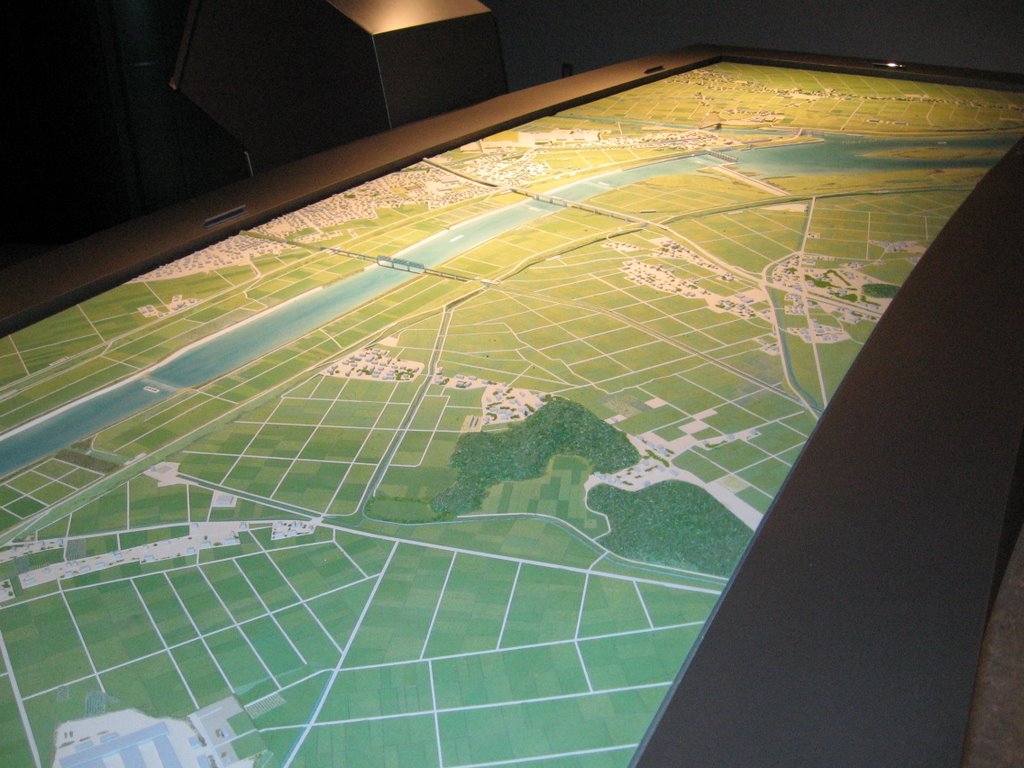 ^ A map showing the area around the dam. Note all the rectangular rice fields everywhere. Somebody went through a lot of trouble to create this map--there were even tiny cars and bushes. I had this sudden urge to buy a Godzilla action figure and have him rampage across the land, crush pedestrians underfoot, and destroy the dam.
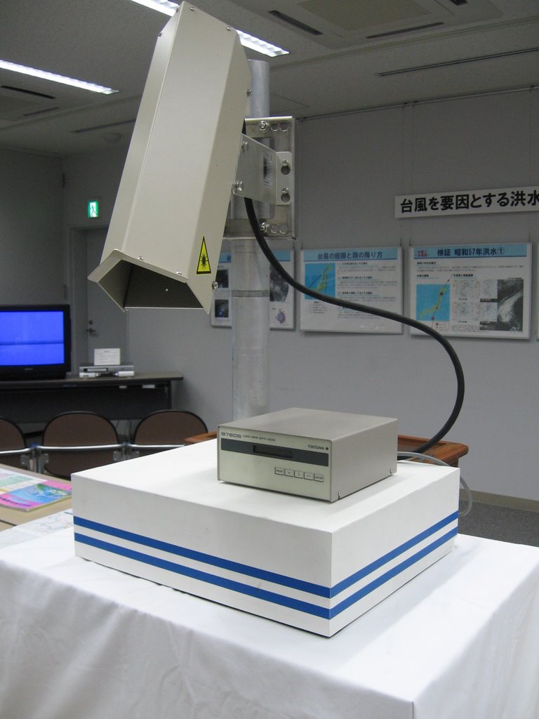 ^ This machine is a "Laser Snow Depth Gauge". Attention all guys: you need to get one of these! Snowblowers and GPS trackers don't do it anymore; now you need a laser to have true gadget bragging rights.
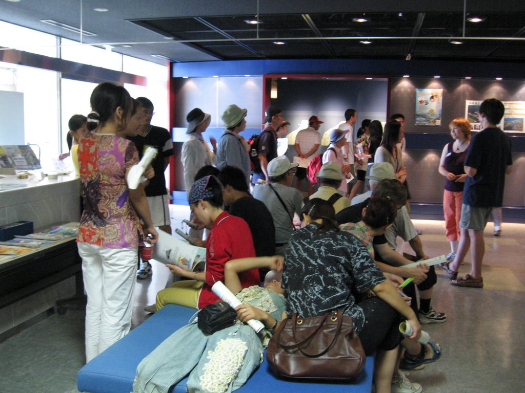 ^ At the end of the day-long tour, everyone was worn out. We're here relaxing in the museum lobby, but now it's time to go home. What a great day it was!
Next: A Trip to Tokyo. ~Oyasumi!
posted by David @ 7:59 PM
0 comments
![]()


0 Comments:
Post a Comment
<< Home